Project Goal
This project analyzed and interpolated groundwater depth and aquifer data from across the United States. Using recent data from the USGS National Groundwater Information System, I created interpolations of current groundwater depth and compared modeling methods. The resulting raster data can then inform the current status of various aquifers around the country.
Project Resources
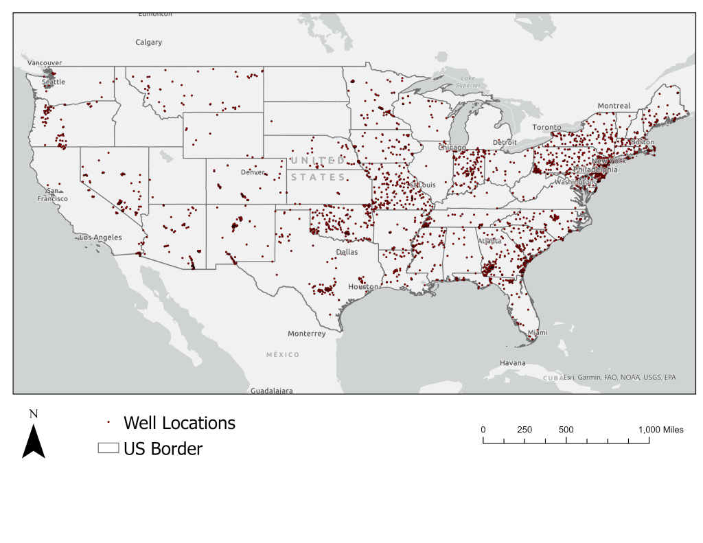
Data for this project was sourced from USGS’s National Water Information System which obtains data from springs, wells, test holes, tunnels, drains and includes location information and depth. Other data sources for groundwater include the USGS National Groundwater Dashboard and the National Ground-water Monitoring Network. To complete this process I used queries, geospatial interpolation, spatial joins, and raster/vector conversion tools.
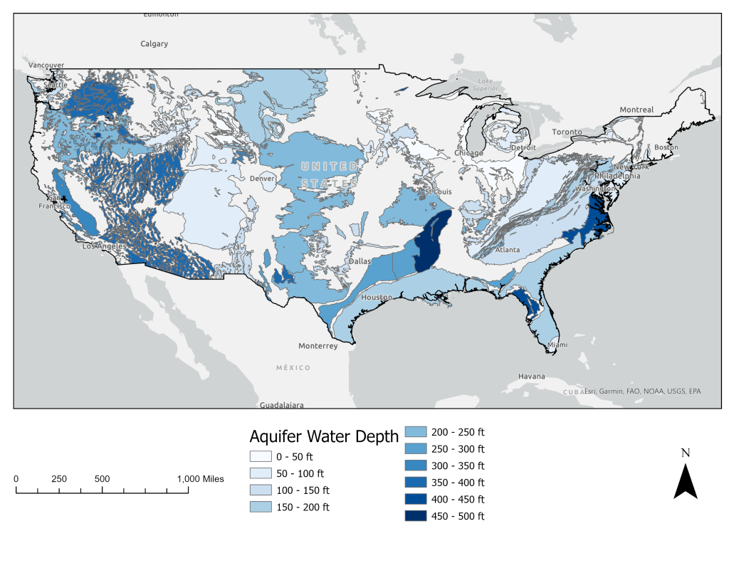
Results
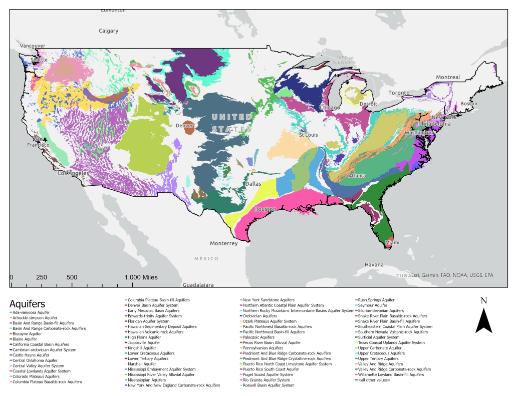
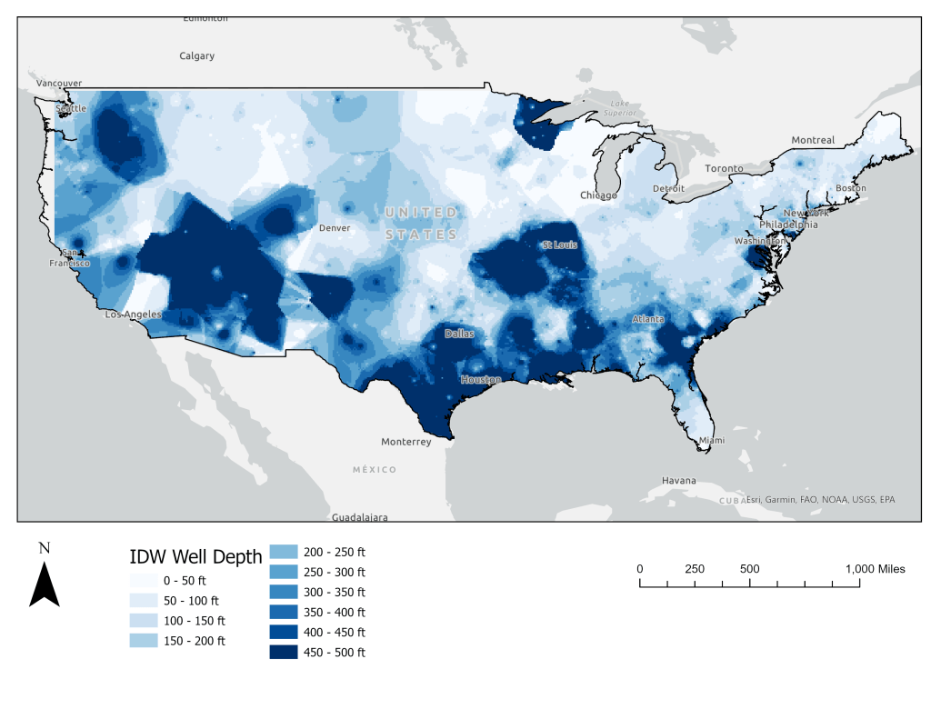
Results indicate that groundwater well data can be properly interpolated using an Inverse Distance Weighing (IDW) Model. The IDW model describes shallow aquifers (>100 ft) exist in the midwest and four corners regions. Deeper aquifers are found in parts of Louisiana, the east coast, and the mountain west.
The Central Valley of California is of interest due to its agricultural value. The area also experiences increasing soil subsidence due to overdrawing of the Central Valley Aquifer System. This project could serve as a long-term monitoring method and may be used to study the changes undergone by these substantial aquifers across our country.
A next step for this project would be to gather more data from a variety of dates (1x per year). Conduct the same analysis on this data. Then perform a change-vector analysis to see rates of water depth change over time.
